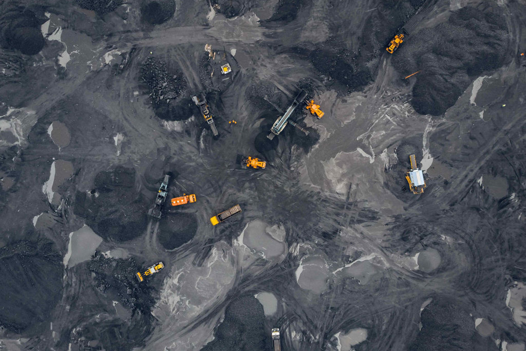
Overview
Mining processes are highly labor-intensive and require considerable investments to ensure the safety of workers and prevent pilferage from stockpiles. Mining companies continuously explore new technologies to reduce costs and improve productivity, margins, and worker safety. Companies can achieve this if mining operations are planned thoroughly, the assets are inspected regularly, and the mining site is kept under surveillance. However, conventional methods are inefficient to keep up with increasingly stringent environmental and labor regulations. Drones have become a vital tool in the mining industry in recent years because of the ability of drones to access remote areas much faster than conventional methods. Drones in the mining industry are helping companies to gain far greater levels of data far quicker than was previously possible, thereby aiding the decision-making processes for business leaders.
5 ways how drones are used in Mining Industry?
1. Surveying and Mapping
Usually, surveying and mapping mineral landscapes is a time-consuming process. The speed and accuracy of drone surveys make regular mapping quick and easy, providing real-time data and the opportunity to identify potential issues early and act to prevent them. Drones surveys in the Mining industry can provide detailed information about the sites before starting with mining projects and document their progress to visualize changes in site over time. Collecting data as often as they like provides managers and supervisors with improved inventories and reduces the risk to surveyors and miners.
Capturing data with a drone is faster than with traditional methods and does not require a surveyor on site. Changes between the two surveys can be tracked and emphasized automatically. Over the long term, the costs of mapping and monitoring are substantially decreased.
Up to 30 x faster data collection
2. Monitoring and Inspection
Mining is among the most hazardous industries for workers, particularly those performing deep underground activities. Workers can be subjected to rock falls, highly humid conditions, gas leaks, dust explosions, and floods. Therefore, mining companies have used drones in underground mines to monitor and inspect deep shafts. In addition, drones are also being employed to inspect mining equipment, which is an expensive and time-consuming process requiring a highly skilled workforce. Moreover, the inspection’s brief time allotted may affect the quality of data collected manually.
“100 % safe surveying operations on site.” Nowadays, AI-powered autonomous drones are available in the industry that flies anywhere by themselves, even underground, with no outside data source, built-in maps, and operator in control.

3. Stockpile Management
Estimating the volume of stockpiles using traditional methods has always been tricky due to their irregular shape and structure. By providing thousands of data points for one stockpile, drone surveys are far more accurate than GNSS and total stations Surveys. Drones identify all unevenness and undulation surfaces. Drone surveys make it possible to reduce the deviation in stockpile volume calculations, generate improved base files for stockpiling, and produce more accurate financial statements and regulatory checks.

Traditional GNSS and Total Station surveys can collect only a few data points. Craters and steep slopes are often overlooked.

Drone surveys collect hundreds of data points, including steep slopes of craters, sometimes invisible from the ground.
The cut, fill, net volume and area are automatically calculated once a shape is drawn over a stockpile. Drones can accurately measure multiple volumes simultaneously, and They can share the data electronically.
Accurate site models produced from aerial images allow companies to ensure the volume of material to be extracted or moved according to plans or legal standards.
4. Haulage Road Optimisation
The haul road network has a considerable impact on the efficiency of mining activities. To achieve safe and uniform transit, Engineers must constantly monitor haul road conditions. Drones can facilitate this process by collecting a large amount of aerial data, covering huge areas more precisely, which engineers can then use for planning, designing, construction, and maintenance activities.
5. Water and Sediment Flow Management
Drones in mining can also help prevent operations disruption due to unwanted or uncontrolled water or sediment flow. Engineers can model flow and tailings dam operations from the digital elevation maps produced by drone images. Because it is possible to fly frequently with a drone, you can create a visual record of the site over time, monitor progress weekly or monthly, and store this for future operations or regulatory audits. By analyzing the collected data on a digital platform, mining companies can maintain the structural integrity of the tailings dam, design expansion, and avoid failure.
Data-Driven Decisions
The ability to read, analyze, process, and transmit data in real-time makes drones valuable mining resources. Mining companies can use drones to identify the volumetric analysis of piles and overburden dumps. They are also used to analyze bench slopes’ height, width, and depth and provide vital topographic information. The information gathered ensures that mining is carried out by following plans and regulations. Furthermore, data collected by drones are used for dynamic re-scheduling, monitoring congestion, and predicting water and sediment flow. These benefits ensure sound decision-making and decrease chances of physical harm, wasted resources, and overspending. Accurate predictions make initial decisions accurate. Changing conditions are identified sooner and dealt with quicker based on data-driven decisions, leading to a safer working environment, lower costs and minimal impact on the local and global environment. Similarly, drones can help run blast simulations, providing helpful information for mining engineers.
Conclusion
India is rich in coal, iron ore, lead, and zinc reserves, and the government is keen to tap into the significant amounts of money that government can make through mining. This is evident in recent reforms made within the mining sector and suggests that now is the time for mining companies to invest in state-of-the-art technology that will help them realize the value of their assets.
Across the Industry, there are already many examples of private and public-owned mines using drone technology to digitize their mines. But as an industry, Indian mining is way behind some other parts of the world in its adoption of modern processes. This lag in embracing technology results from mining companies waiting on the introduction of regulation on drone usage before buying them and a general reluctance to invest in untested technology. The announcement of a governance model legalizing and regulating the operation of drones for civil use in India resolves the first issue. The results from around the rest of the world should dispel any concerns about the second. Indeed, drones have been used in some locations to increase transparency and help bridge the gap between industry and regulator.