Introduction
Renewable energy in any form is one of the most important needs in today’s times to promote science and help mankind perform better in various fields. The world is facing a rapid increase in population and GDP consumption, thus forcing us to look for an alternate energy resource hoping to create an equitable balance between energy needs, growth, and environmental capability. Energy resources like solar, hydro, wind and geothermal ensure sufficient energy. Solar and wind energies, in particular, have emerged to be the favourites of ecologists and new age statisticians worldwide since they never run out, require less maintenance, and comparatively lesser in price.

The year 2019 saw an 81% massive increase in solar installations in the EU where Europe’s biggest nations, Germany, France, Spain and Italy made huge investments in Solar Energy, thus portraying it as one of the most promising resources of the future. Solar energy is the future of India and the rest of the world.
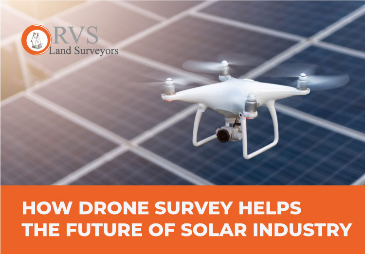
One of the key driving factors for adopting new emerging resources is the decline in capital cost. This post aims to help the reader understand How Drones act as a driving force in enhancing the planning, building and nourishment of solar energy with better profitability and efficiency.
Solar energy is captured in many forms. The major two primary ways of capturing solar energy are using utility-grade plants and rooftops. Drones can be used in both these ways, but let’s concentrate on Utility grade plants for now considering their wide usage in India.

Source: Bridge to India research
Solar Power in India
With India enjoying an average of 2856 hours of sunlight every year, it’s no surprise that the Government wants to harness that kinetic energy and put it to good use. Supported by the Indian Technical and Economic Cooperation (ITEC), the Indian Government laid out plans in 2008 with a commitment to achieve the capacity for 20 Gigawatts (GW) of solar power by 2022. Surprisingly India achieved that figure by 2018 itself, and the Government announced a revised target of 100 GW of solar power by 2022 and has so far achieved installation of 35 GW. To achieve India’s ambitious target of 100 GW, we have to install 65 GW in the coming years.
As per the standard thumb rule, to install 1MW, we require 5 acres of land, which means to achieve a target of 65 GW, we would require about 3,25,000 acres. This demands quite a lot of planning and surveying.
For a solar project, it’s quite challenging to generate purchase bids quickly to be a part of the competition. And again for the project report, we require the topographical information of the respective solar farm. Traditionally we have two options to collect information: relay on publicly available data (like Google Maps) or conduct new ground surveys. Unfortunately, both are not ideal for large-scale projects like solar farms. Drones being an easier form of the survey can cut down the process of collecting such information to a few days, resulting in faster turnaround times and a leg up on the competition.
“Drones can also decrease the design cycle of solar energy projects by as much as 70%, and increase team productivity in the long run.”
Top 5 Solar Installation States

The increased demand for solar installation among individuals and organizations brings logistical challenges. New housing and commercial developments across the country are increasingly installing rooftop solar panels. There is also a rise in demand for solar energy farms (or photovoltaic plants) to help support communities by transforming a large amount of the sun’s energy into consumable electricity. Solar energy is also a sustainable and Eco-friendly energy source that allows nations and organizations to commit to protecting the planet’s future, and that needs vast swathes of land which require quick and efficient Topography.
Major 5 cases in Usage of Drones in solar operation
1. Surveying:
Drone technology can provide high-resolution data to aid site selection within a fraction of the time and at affordable costs than using manual methods. It identifies misalignments, erosion data and provides information on soil and vegetation.
One can use the data captured to produce thermal and visual imagery, highly accurate digital terrain maps and CAD models. These represent the accurate area and provide more knowledge than the other traditional surveying methods.
Drones can also provide details of a water body, generator proximity, and other particulars such as soil type. This information guides project managers to decide on the appropriate site for solar panel installation. The accuracy of drone surveys helps to avoid unnecessary cost escalation once the project is underway.
It also reduces the time taken to provide a quotation from weeks to days. It’s a quicker and more efficient solution for all parties than has ever been available before.
Drone surveying provides data in a precise and sufficient detailed format. Surveyors can carry out surveys that once used to demand a lot of manpower and travel. This again helps in a lot of cost cutting.

2. Construction Monitoring:
Traditionally, it’s been quite challenging to monitor construction work without spending a considerable amount of time and energy on the workforce. However, with Drones, we can survey sites around the clock, providing advanced surveillance and keeping the location secure. While the project is underway, drone technology allows for regular scanning of the area for early detection of problems. For solar energy farms, though, construction is just the beginning of the journey. When constructing a solar farm, drones are vital in ensuring it is situated in the best place to serve its consumers best.

3. Inspections:
One of the issues with solar panels since their introduction is that, while they reduce carbon emissions and cut energy costs, they are fragile. Solar panels are prone to damage from these elements and, like most things; early intervention is the key to protect them. Spotting the wear and tear signs in their infancy helps to deal with issues immediately thus detecting larger problems coming our way. This ensures peak performance levels and reduces the likelihood of more costly and disruptive repair work in the later stages. Any anomalies are detected, classified, and localized, thus diagnosing the problem and identifying the most appropriate solution quickly and efficiently. Many solar farms are advised to conduct an annual inspection and a drone survey. This provides the opportunity to meet all kinds of obligations without the undue expense of disruption.

4. Performance Measurement:
Remote surveying ensures that commitments are met without the necessity of employees’ working dangerously for long hours or putting themselves at risk by climbing up on rooftops etc. But it is not just the solar panels alone that need regular inspection but also electrical substations, lines and poles to monitor proper safety and efficiency. Drones can pinpoint minor errors quicker than manual methods so one can fix issues without unnecessary delay. Any successful solar operation needs to conduct continuous performance monitoring, and drones contribute in a large way. Drones are also capable of providing thermal readings and zooming in on each panel specifically. They help your operation continue running as smoothly as possible.
5. Accessible, Actionable Data:
“Drone surveys provide advanced aerial data acquisition properties and acquire data 50 times faster than manual methods.”
With AI and machine learning, a drone can identify problems with solar panels 80% faster than a team of engineers. That means a drone inspection will take one day, whereas a team of highly paid electrical engineers will take a week. Again they are not prone to human errors and provide far more reliable data that is compatible and has a variety of software solutions for real-time analysis.
5 Benefits of Drones for Solar Power
Drones offer a wide selection of benefits for the Solar Industry. These include the following:
1. Improved Safety
Using drones for solar system inspections are a great way to keep techs and teams safe. To ensure solar farms are operating efficiently technicians must open combiners and inverters. Having any direct contact with these highly-charged components can be very dangerous. Drone inspections, however, can remotely pinpoint faults and thus safeguard the technicians from exposure to these dangerous components and shock risk.
2. Reduction of Labor Costs
Drones are inexpensive, easy to deploy, and simple to operate. Using them for Solar Panel inspections makes processes more accurate and precise than ever before. Drones, in turn, reduces labor costs and cuts time on-site.
3. Increased Efficiency
UAVs can access any location, thus making them a favorite tool among companies that want to scale their inspection processes. Today, drones easily conduct highly efficient inspections by covering a site in less time and providing high-resolution images.
4. Increased Visibility
In the case of manual inspections, Engineers/Technicians cannot inspect every individual module. That is there are many chances of Engineers/Technicians overlooking anomalies and essential information. With drones, onboard sensors, mapping technologies, and thermal cameras all issues are reduced to a granular level with better comprehensive visibility and a simplified clear understanding of the site status.
5. Storing and Retrieving data
Industrial drone technology has revolutionized data collection. Today, inspectors using drones can survey a site at an average of 10x times faster than they could manually do it. What’s more, the data they collect is more accurate and detailed than data collected manually. One can store drone data on guarded portals for future references to their convenience and for timely reporting. The data can be accessed through various devices for further interpretations whenever needed. We can also establish and personalize trends in the data in-depth for decision making in the future. Drone data is stored and backed up automatically and can be accessed quickly and easily if required later. It can be cross-verified with the previous and current data to help identify areas of concern or aspects of the operation where there are inefficiencies that need to be resolved.
5 Common solar panels defects recognized during Drone Inspection
1. Hot spots – Causes rapid degradation of solar cells.

Hot spots are places on the panels that are overloaded and therefore become warm; it can ultimately lead to a short-circuit and reduce the solar panel’s performance and lifespan.
2. Microcracks – Signs of low production quality.

It can occur during solar modules production, shipping, careless handling or low quality. Microcracks won’t show immediate production loss but can grow over time. Larger microcracks will damage the solar cells, and this will lead to production loss.
3. Snail trail contamination – Initial stages of microcracks.

Snail trail is a discolouration of the panel which usually occurs after a couple of years of production. There can be many causes for this defect, and some include defective front metallisation silver paste in the solar cell production and others. These snail trails can also arise as a result of microscopic cracks in the panel.
4. PID effect – damage solar cells and reduce energy yield.

PID stands for Potential Induced Degradation. It occurs due to the difference in voltage between the panel and the earthing, leading to a reduction in the solar panel’s performance and quicker accelerated ageing.
5. Internal corrosion and delamination – can shade solar cells.

This is one of the most common problems of solar panels. When moisture, dust and organic debris drain into the panel, it can lead to internal corrosion, shades on the solar cells, and when left unnoticed becomes visible dark spots on the panel. The panel’s output will decrease if the size of corroded areas increases.
Conclusion:
Drone Survey Solutions have incredible potential to transform energy industries by automating how we plan, build and maintain renewable energy sources. It completes tasks faster, cost-effective, and more safely than humans ever could. When compared to the overall share of global power generation, solar energy still remains low. But with technologies like thermal imagery, 3D modelling and drone survey solutions one can bring upon a larger paradigm shift. Across the globe, people are seeking more sustainable energy sources as other natural resources are running out. A growing number of companies are providing Drone-based outputs into their workflows. If solar energy is the future of the world, then drone surveying is most definitely the future of solar technology.