The architectural industry is undergoing a technological revolution, and land surveying is no exception. Innovative technologies are transforming traditional surveying methods, making them more efficient, accurate, and versatile. This evolution not only enhances the capabilities of land surveyors but also significantly impacts the architectural field, enabling architects to design and build with unprecedented precision and creativity. This blog post will explore the future of land surveying and the cutting-edge technologies shaping the industry.
Key Takeaways
- Technological Advancements: Explore how land surveying has evolved with digital tools like GPS, drones, and 3D laser scanning.
- Precision and Accuracy: Understand how these technologies enhance site measurements, reduce errors, and improve construction quality.
- Efficiency and Productivity: Discover land surveys’ increased efficiency and speed thanks to innovative tools, leading to faster project timelines and cost savings.
- Comprehensive Visualisation: Explore the benefits of detailed visualisation and analysis of site data using GIS and BIM, informing better design decisions.
- Collaboration and Integration: Investigate how integrating survey data with design tools improves collaboration among architects, engineers, and contractors.
- Future Trends: Gain insights into emerging trends in land surveying and architecture, such as AI, machine learning, AR, VR, and sustainable design.
These key takeaways highlight the transformative impact of innovative technologies on land surveying and the architectural industry, emphasising the benefits of precision, efficiency, and improved collaboration.
The Evolution of Land Surveying
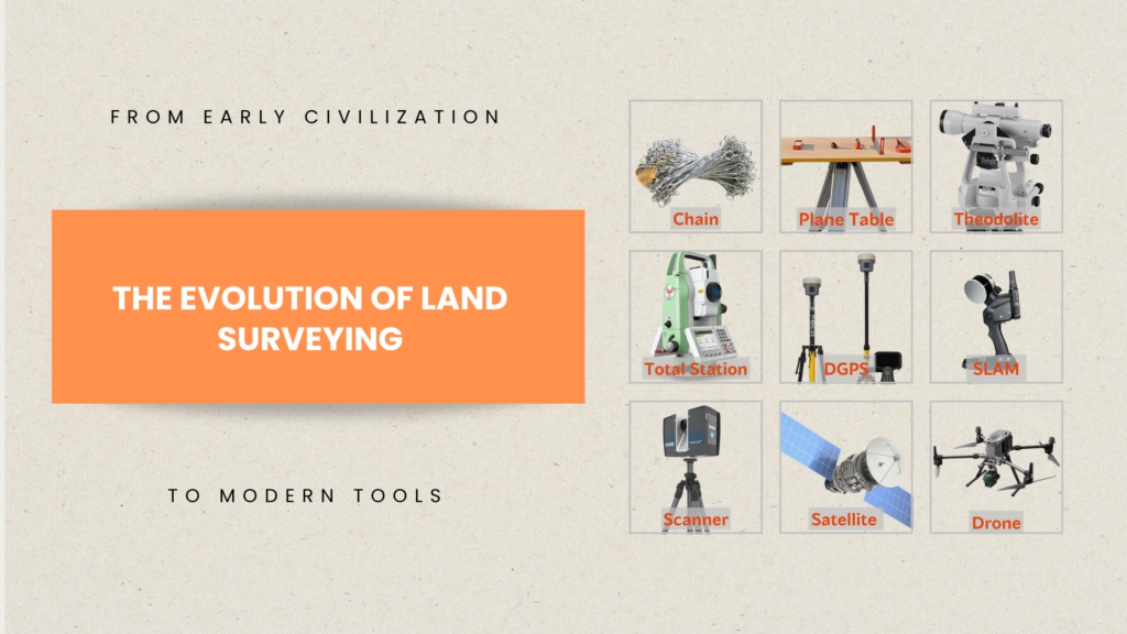
Land surveying has a rich history that dates back to ancient civilisations. From the early use of ropes and chains to measure land to the development of theodolites and total stations, the tools and techniques of land surveying have continually evolved. However, digital technology has accelerated this evolution, introducing a new era of high-tech surveying tools.
Traditional land surveying relied heavily on manual measurements and calculations, which were time-consuming and prone to errors. Today, digital tools such as GPS, drones, and 3D laser scanners have revolutionised the field, providing more accurate data in a fraction of the time. These technologies have not only improved the efficiency and accuracy of land surveys but have also expanded the possibilities for architects.
Innovative Technologies in Land Surveying

1. Global Positioning System (GPS)
GPS technology has been a game-changer in land surveying. By using satellites to triangulate positions, GPS can provide precise location data anywhere on Earth. This technology has significantly reduced the time required for land surveys and has increased the accuracy of measurements.
For architects, GPS technology offers numerous benefits. It allows for the creation of highly accurate site plans, which are essential for the initial stages of design and construction. GPS data can also be integrated with other digital tools, such as Geographic Information Systems (GIS) and Building Information Modeling (BIM), to provide a comprehensive view of a site and its surroundings.
Explore GPS in this blog as we delve into Different GPS surveying techniques for accurate land mapping
2. Drones
Drones, or unmanned aerial vehicles (UAVs), have quickly become a valuable tool in land surveying. Equipped with high-resolution cameras and sensors, drones can capture detailed aerial images and topographic data. This information can be processed to create accurate 3D models of the terrain, which can be used for site analysis, planning, and design.
Drones offer several advantages over traditional surveying methods. They can cover large areas quickly, access hard-to-reach locations, and provide real-time data. For architects, this means more detailed and up-to-date information about a site, which can inform better design decisions and improve project outcomes.
Discover more about drones in this blog Drone Surveying in India
3. 3D Laser Scanning
3D laser scanning, also known as LiDAR (Light Detection and Ranging), is another transformative technology in land surveying. By emitting laser pulses and measuring their return times, LiDAR can create highly accurate 3D models of the environment. This technology is particularly useful for capturing complex geometries and detailed surface features.
In the architectural industry, 3D laser scanning is used to create precise as-built models of existing structures, which can be invaluable for renovation and restoration projects. It also allows architects to visualize and analyze the site in three dimensions, leading to more informed design decisions and better integration with the surrounding environment.
Are you ready to revolutionise your architectural projects with 3D laser scanning? Contact us to build a future of precision and creativity together!
4. Geographic Information Systems (GIS)
GIS technology combines spatial data with attribute data to create detailed maps and models of the environment. This technology allows for analysing and visualising complex spatial relationships, making it a powerful tool for land surveying and urban planning.
GIS provides architects with a wealth of information about a site and its context. It can be used to analyse environmental factors such as topography, vegetation, and hydrology, as well as human factors such as land use, zoning, and infrastructure. By integrating GIS data with design tools like BIM, architects can create more informed and sustainable designs.
5. Building Information Modeling (BIM)
BIM is a digital representation of the physical and functional characteristics of a building. It allows for the creation of a detailed 3D model that includes information about the building’s geometry, materials, systems, and performance. BIM has become an essential tool in the architectural industry, providing a collaborative platform for design, construction, and operation.
The integration of BIM with land surveying technologies offers numerous benefits. It allows for the seamless transfer of survey data into the design process, ensuring that the architectural model accurately reflects the site conditions. This integration also facilitates better coordination between architects, engineers, and contractors, reducing errors and improving project efficiency.
Want to dive deeper into BIM? Check it out here Land Surveying in BIM – AEC Industry
The Impact of Innovative Technologies on the Architectural Industry
The adoption of innovative land surveying technologies is having a profound impact on the architectural industry. These technologies are not only improving the accuracy and efficiency of surveys but are also enabling new possibilities in design and construction.
Enhanced Precision and Accuracy
One of the most significant benefits of advanced surveying technologies is the increased precision and accuracy they offer. GPS, drones, and LiDAR can capture detailed and accurate data about a site, which is essential for creating precise architectural designs. This level of accuracy reduces the risk of errors and discrepancies, leading to higher-quality construction and fewer costly reworks.
Improved Efficiency and Productivity
Innovative surveying technologies are also improving the efficiency and productivity of land surveys. Drones can cover large areas quickly, GPS can provide instant location data, and 3D laser scanners can capture detailed models in a matter of minutes. This increased efficiency allows surveyors to complete their work faster, which can speed up the overall project timeline and reduce costs.
Better Visualization and Analysis
Advanced surveying technologies provide architects with more detailed and comprehensive data about a site. This information can be visualized and analyzed in various ways, using tools like GIS and BIM. For example, architects can create 3D models of the site, analyze topographic and environmental factors, and assess the impact of different design options. This improved visualization and analysis can lead to better-informed design decisions and more innovative and sustainable projects.
Enhanced Collaboration and Integration
The integration of surveying technologies with design tools like BIM is also enhancing collaboration and integration within the architectural industry. By sharing accurate and up-to-date survey data, architects, engineers, and contractors can work more effectively together, reducing the risk of errors and improving project outcomes. This collaborative approach is essential for the successful delivery of complex projects, particularly those that involve multiple stakeholders and disciplines.
Challenges and Future Trend
While the future of land surveying is undoubtedly exciting, there are also challenges to consider. The adoption of new technologies requires significant investment in equipment, software, and training. There are also concerns about data security and privacy, particularly with the use of drones and other remote sensing technologies.
However, the potential benefits of these technologies far outweigh the challenges. As the architectural industry continues to embrace digital transformation, we can expect to see even more innovative tools and techniques emerging in the field of land surveying.
Artificial Intelligence and Machine Learning
Artificial intelligence (AI) and machine learning (ML) are poised to play a significant role in the future of land surveying. These technologies can be used to automate data processing and analysis, reducing the time and effort required for surveys. AI and ML can also help to identify patterns and trends in survey data, providing valuable insights for architects and planners.
Augmented Reality and Virtual Reality
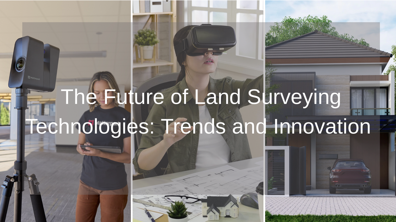
Augmented reality (AR) and virtual reality (VR) are also set to transform the way architects and surveyors work. These technologies can be used to create immersive 3D models of a site, allowing architects to visualize and explore their designs in a virtual environment. AR and VR can also be used to overlay survey data onto the physical world, providing real-time information during site visits and construction. In AR and VR applications, Matterports provide high-quality, textured visuals that enhance realism in virtual environments. Matterport bridges the gap between raw data and realistic visualization, making AR/VR tools more impactful in modern surveying. For land surveying and architecture, they offer:
- Photorealistic Site Views: Combining survey data with detailed textures for lifelike simulations.
- Improved Contextual Design: Showing how proposed structures interact with real environments.
- Effective Client Presentations: Helping clients visualize projects more clearly.
- Enhanced Virtual Walkthroughs: Enabling immersive design reviews before construction.
Sustainable and Resilient Design
As the world faces increasing environmental challenges, there is a growing emphasis on sustainable and resilient design. Innovative surveying technologies can support this by providing detailed data about the environmental conditions of a site, such as topography, vegetation, and hydrology. This information can be used to design buildings that are more energy-efficient, environmentally friendly, and resilient to climate change.
Conclusion
The future of land surveying is bright, with innovative technologies transforming the way surveyors and architects work. From GPS and drones to 3D laser scanning and GIS, these tools are enhancing the accuracy, efficiency, and capabilities of land surveys. For architects, this means more precise and informed designs, improved project outcomes, and new possibilities for creativity and innovation.
As the architectural industry continues to embrace these technologies, we can expect to see even more exciting developments in the field of land surveying. By staying at the forefront of these trends, architects and surveyors can ensure that they are well-equipped to meet the challenges and opportunities of the future.
Call to Action
Are you ready to embrace the future of land surveying and take your architectural projects to the next level? Stay informed about the latest trends and technologies by subscribing to our blog. Together, we can build a more precise, efficient, and sustainable future.


